

Select NOAA-NWS Forecast Office Text Products
(Product availability varies with seasons, forecast office, and weather.)
Hazardous Weather Outlook for Portland, ME
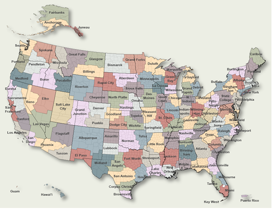
To Select Another NWS Office Click on Map or Choose from List
|
| Select Forecast Office: | Select Product: |
660 FLUS41 KGYX 301931 HWOGYX Hazardous Weather Outlook National Weather Service Gray ME 331 PM EDT Wed Apr 30 2025 MEZ023>028-011945- Coastal York-Coastal Cumberland-Sagadahoc-Lincoln-Knox-Coastal Waldo- 331 PM EDT Wed Apr 30 2025 ...FROST ADVISORY IN EFFECT FROM 2 AM TO 8 AM EDT THURSDAY... This Hazardous Weather Outlook is for south central Maine and southwest Maine. .DAY ONE...This afternoon and tonight. Please listen to NOAA Weather Radio or go to weather.gov on the Internet for more information about the following hazards. Frost Advisory. .DAYS TWO THROUGH SEVEN...Thursday through Tuesday. Please listen to NOAA Weather Radio or go to weather.gov on the Internet for more information about the following hazards. Frost Advisory. .SPOTTER INFORMATION STATEMENT... Spotter activation is not expected at this time. $$ MEZ007>009-012>014-018>022-033-NHZ001>015-011945- Northern Oxford-Northern Franklin-Central Somerset-Southern Oxford- Southern Franklin-Southern Somerset-Interior York- Central Interior Cumberland-Androscoggin-Kennebec-Interior Waldo- Interior Cumberland Highlands-Northern Coos-Southern Coos- Northern Grafton-Northern Carroll-Southern Grafton-Southern Carroll- Sullivan-Merrimack-Belknap-Strafford-Cheshire-Eastern Hillsborough- Interior Rockingham-Coastal Rockingham- Western And Central Hillsborough- 331 PM EDT Wed Apr 30 2025 This Hazardous Weather Outlook is for Maine, south central Maine, southwest Maine, west central Maine, western Maine, New Hampshire, central New Hampshire, northern New Hampshire and southern New Hampshire. .DAY ONE...This afternoon and tonight. No hazardous weather is expected at this time. .DAYS TWO THROUGH SEVEN...Thursday through Tuesday. No hazardous weather is expected at this time. .SPOTTER INFORMATION STATEMENT... Spotter activation is not expected at this time. $$ ANZ150>154-011945- Coastal Waters from Stonington, ME to Port Clyde, ME out 25 NM- Penobscot Bay- Coastal Waters from Port Clyde, ME to Cape Elizabeth, ME out 25 NM- Casco Bay- Coastal Waters from Cape Elizabeth, ME to Merrimack River, MA out 25 NM- 331 PM EDT Wed Apr 30 2025 This Hazardous Weather Outlook is for Atlantic coastal waters. .DAY ONE...This afternoon and tonight. No hazardous weather is expected at this time. .DAYS TWO THROUGH SEVEN...Thursday through Tuesday. No hazardous weather is expected at this time. .SPOTTER INFORMATION STATEMENT... Spotter activation is not expected at this time. $$ |
Previous Hazardous Weather Outlooks may be found at
NWS Portland, ME (GYX) Office Hazardous Weather Outlooks.
(Click 'Previous Version' there to view past versions successively.
Some may differ only in time posted.)
Products Courtesy of NOAA-NWS
NWS Information Parsing Script by Ken True at Saratoga Weather - WFO and Products Scripts by SE Lincoln Weather.
Mapping by Curly at Michiana Weather and by Tom at My Mishawaka Weather.
